We offer a wide range of very high quality Plane Table Accessories that are suitable for maps preparation and recording topography in various engineering surveys.
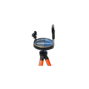
This outfit consists of a plane table board with a fitted tripod.
These products undergo various quality tests at each level of its production to ensure good quality and flawless performances.
These products are basically used in the construction industry for the purpose for surveying the land for commercial use.
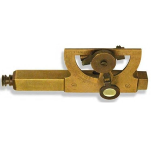
Consists of telescope eyesight and an adjustable tubular spirit level, which is connected to a semicircular protractor scale and vernier marked in both slope and degrees (90°).
A magnifier glass assists in accurate reading the degree of inclination from vernier.
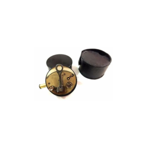
Cylindrical brass sextant in leather case. The sextand has pull out eyepieces, silvered scale and vernier magnifier on a hinged arm.
The brass cover screws onto the base as a handle.
The leather case is embossed with a flower on both sides.
The case has an attached cover which fastens with a strap.
The inside of the case is lined with purple velvet like material.
Maker's mark on sextand, embossed stamp on case.
• 100 braced links.
• 2 rings per link.
• 0.10 wire.
• Cast brass handles.
• Adjustable calibration and tally tags at ± 10, 20, 30, 40 and centre on side rings.
• Measuring chains with brass handles and arrows 20 m, 30 m, 40 m and 50m.
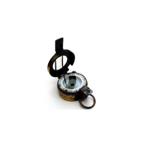
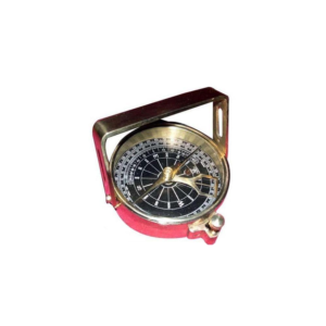
Clinometer Handle Compass is a reproduction of an antique Clinometer compass. The Handle Compass gets its name from its "handle" shaped sight, which actually serves two purposes With the compass level, an object can be viewed through the peep sights to determine its magnetic heading. The second and most interesting purpose is when tilting the compass on its side and viewing an object through the sights, its angle of elevation or declination can be found. A weighted pendulous arm beneath the compass needle can be read from one of three scales : Angle in degrees beneath the zenith (from straight up), angle in degrees of elevation or declination, and in inches per yard of slope. The compass has a needle lift mechanism to protect the compass jewel and the pendulous arm when being transported.
• Compass survey is a method of surveying by taking bearings and linear distances to produce plan.
• Bearing is measured using prismatic compass, while the linear distance is measured using measuring tape.
• Bearing in compass surveying means angle is made by chain line or survey line by referring it to magnetic meridian or magnetic north.
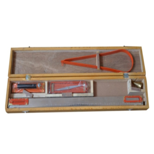
The Plane Table Surveying Instruments include standard accessories like Trough Compass, Spirit level, Canvas cover, Plumbing Fork etc., and is also with a fitted tripod.
Uses of Plane Table in Engineering Surveys:
• Maps preparation
• Recording topography
Accessories included in Plane Table Surveying Instruments:
• Plane Table Board 750 x 600 mm, thickness 22mm & 16mm
• Carrying Bag for Board
• Teak wood Polished Stand
• Stand Rigid Brass Head & Plate,
• Magnet Trough compass brass
• Spirit Level brass
• Sight van 24"
• Plumbing Fork
• Plumb Bob
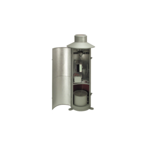
Rain gauge is designed to measure the precipitation. This small Version consisting of upper and lower housing part, measuring cylinder; Housing made of stainless steel, orifice rim made of brass.
Type 7019.0000 can be supplied with a receiving area of 100 cm2. (This type is not conforming to meteorological standards).
• Receiving area : 100 cm².
• Rain measure (graduated glass) : 250 cm³.
• Measuring range : 0 t0 25 mm precipitation (relative to a receiving area of 100 cm²).
• Graduation : 1/1 mm precipitation.
• Dimensions : dia 115 mm; height 300 mm.
• Weight : approx. 0.8 kg.
















Reviews
There are no reviews yet.